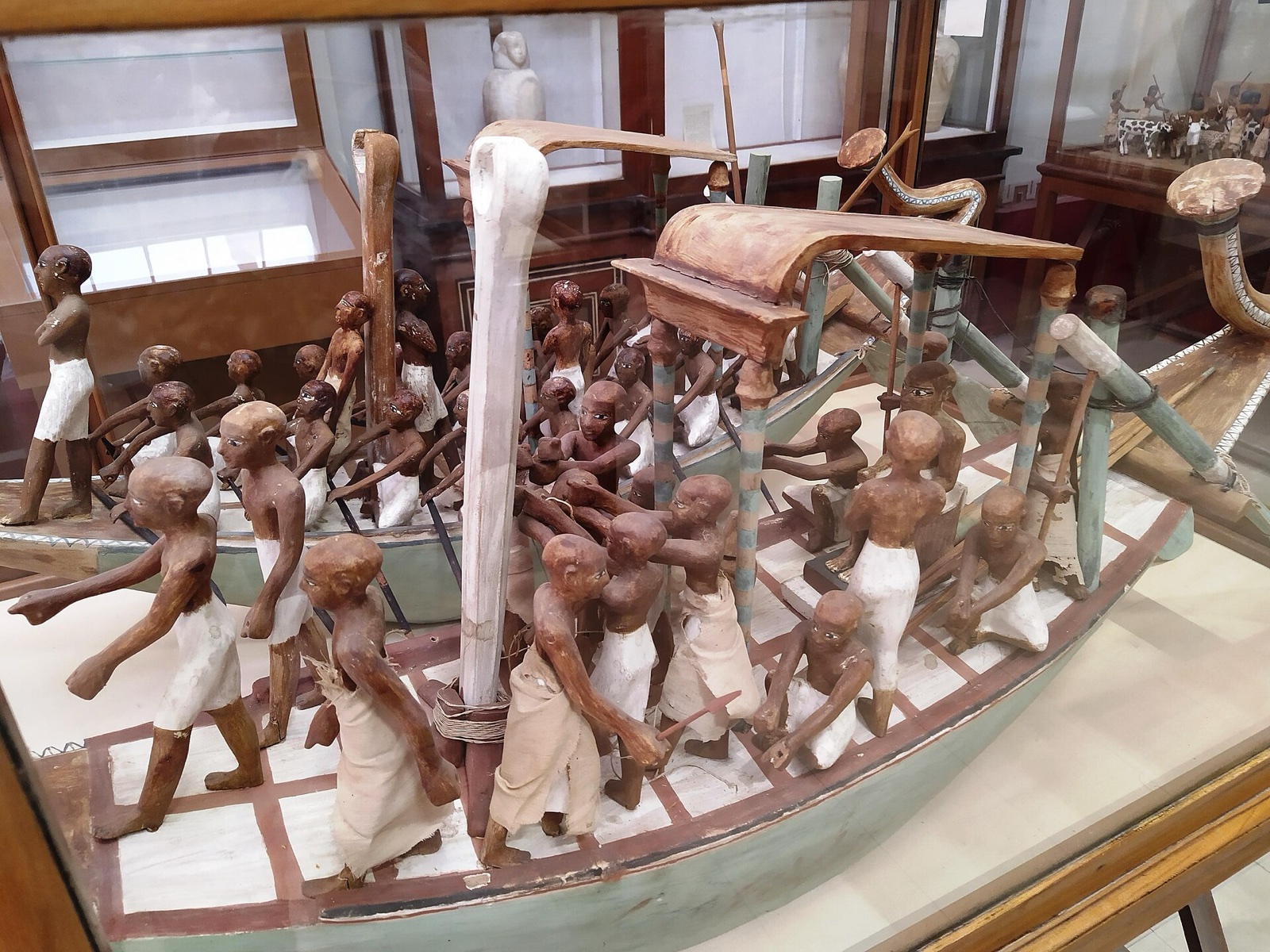
The Nile is often presented as a timeless source of Egyptian civilization. Museums become more useful when the river is treated as a changing system of movement, settlement, labor, political connection and environmental risk.
Begin with the object that moves
A model boat, paddle, rope, cargo container or river scene turns geography into action. Ask what moved, in which direction and under whose organization. A funerary model may not document an ordinary journey directly, so keep ritual purpose and practical knowledge together without collapsing them.
Read maps as authored objects
Check orientation, date range, place names and boundaries. A map centered on dynastic Egypt can make Nubia appear peripheral; a river-based regional map can reveal other centers. Archaeological, political and modern infrastructure maps answer different questions. Compare at least two before treating one diagram as neutral geography.
Connect water with work
Agricultural models and tools can show repeated labor, storage and administration. Avoid turning a model scene into a photograph of everyday life. Look at how tasks are selected, arranged and scaled, then use archaeological context to ask why this version of work accompanied a burial or entered a collection.
Follow the river through institutions
GEM and Tahrir can supply ancient chronology and material; NMEC can connect technology across periods; the Nubia Museum reorganizes the river around regional history, rescue and displacement. The same thread changes because each museum asks a different question.
Include cities and ports
River movement connects quarry, field, temple, workshop and market. Objects made far from their raw material can reveal transport and exchange. Do not assume every foreign material traveled by one route, but let provenance and material identification make logistics part of the interpretation.
Separate season, symbol and evidence
Museum scenes may refer to cultivation, inundation, travel or regeneration, yet an image is never a complete environmental record. Notice plants, animals, water lines and the work being performed, then compare the label's date and archaeological setting. Symbolic meaning and observed river knowledge can coexist. The useful question is not whether a scene is “realistic,” but which parts of the river world its maker selected and which parts were unnecessary for that object's purpose.
Notice control as well as dependence
Water made movement and agriculture possible, but access was organized through labor, institutions and unequal power. Storage vessels, measuring devices, administrative writing and monumental scenes can reveal who counted produce, directed transport or claimed abundance. Place them beside tools and models of work. This prevents the familiar phrase “gift of the Nile” from hiding the human systems that distributed risk and reward.
Hold ancient environment and modern change apart
Modern dams, urban expansion and altered landscapes belong to later histories. They should not be projected backward as unchanged conditions. The Nubia Museum and rescue history make the consequences of large-scale development visible, including preservation achievements and community displacement.
Compare direction, bank and destination
North and south are not interchangeable with downstream and upstream, and east–west relationships vary by site and period. When a label names a port, temple or settlement, locate it relative to the river before imagining the journey. Wind, current, cargo and vessel form shaped movement differently. The goal is not to reconstruct an exact voyage from one model, but to replace a generic “river route” with a set of practical geographic questions.
Use landscape after the museum
At Luxor or Aswan, take one map relationship back outside: bank, quarry direction, temple route or displaced settlement. Place then tests the museum's abstraction. Weather, access and present-day urban life also remind visitors that landscape is not a static ancient backdrop.
Sources reviewed 28 July 2026: NMEC ↗ · Nubia Museum ↗ · UNESCO Nubian Monuments ↗. Displays and visitor conditions may change.